Land Surveying
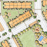
Herriman Townes
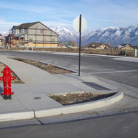
The Herriman Townes is a residential townhome development located at 13400 South 5200 West, Herriman, Utah. The project is comprised of 232 townhome units 52 buildings & clubhouse) on a 12-acre site. Proterra conducted a reconnaissance field survey on the proposed site that included utilities, other man-made improvements, property boundary, and sufficient ground measurements for one-foot contour lines. An ALTA/NSPS Land Title Survey was prepared and filed with the county surveyor’s office. Townhome subdivision plats were also prepared and recorded for the four phases of development. Proterra also provided construction surveying services and survey staked the sanitary sewer system, storm drain collection system, culinary water system, roadway improvements, and buildings.
Land Surveying
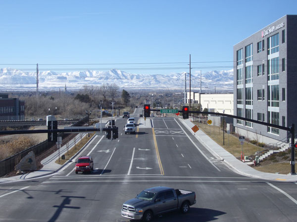
10000 South Roadway Widening
The project consisted of widening the existing 10000 South roadway between 300 West and Jordan Gateway from a two-lane road to a five-lane arterial roadway. The roadway lies on the border of South Jordan City and Sandy City. Proterra researched the recorded property information and conducted a field survey to establish property ownership for each parcel of land that was impacted by the road widening. A record of survey map was prepared and filed at the County Surveyor’s Office to document our findings. A topography field survey was also conducted to measure the natural and man-made features (utilities, etc.) within the impacted area. All measurements were documented in an as-built topography survey map that was utilized for the project’s engineering design work. Based upon the engineering design, Proterra designed the right-of-way and prepared the documents for acquiring the necessary right-of-way and easements. The project was contracted and funded by Sandy City and South Jordan City.
Land Surveying
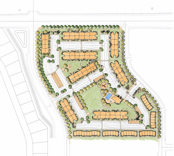
Boulder Canyon Apartments
The Boulder Canyon Apartments is a multi-family residential project that was funded by the United States Department of Housing and Urban Development (HUD). The project is located at 7800 South 5600 West, West Jordan City. It consists of 280 apartment units (14 buildings, five garage buildings, clubhouse building with pool, and 439 parking stalls) and is comprised of 13.6 acres. Proterra researched the recorded property information and conducted a field survey to measure the natural and man-made features (utilities, lines of occupation, etc.) within the impacted area. A survey map was prepared for the apartment lot in accordance with ALTA/NSPS land title survey standards. HUD form 92457 was also included with the survey. Proterra also provided construction survey staking services for all underground, surface, and vertical improvements. Upon construction completion, Proterra prepared the final HUD survey map and associated surveyor’s report.
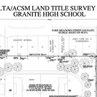
Land Surveying
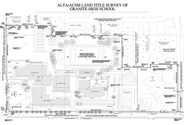
Granite High School ALTA/NSPS Land Title Survey
Proterra prepared an ALTA/NSPS Land Title Survey for the abandoned Granite High School campus located at the 3300 South and 500 East, South Salt Lake City. The campus consists of typical high school buildings, parking lots, and play fields, and is comprised of 27 acres. The survey map was prepared in accordance with the provided requirements and the most current “Minimum Standard Detail Requirements and Classifications for ALTA/NSPS Land Title Surveys”. The survey was based upon a provided commitment for Title Insurance and the vesting deeds for the subject property, each adjoining property, and all instruments referenced as exceptions to coverage by the title commitment. Occupation features and improvements were clearly shown on the survey with descriptions of their character and location in relationship to the property lines established by the title report. Encumbrances as detailed in Schedule B of the Title Report were clearly shown on the survey as required.
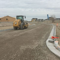
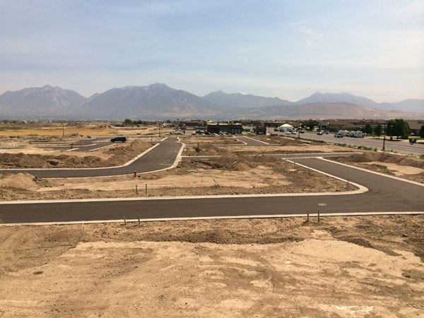
Land Surveying
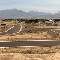
The Cottages at the North District
The Cottages at the North District is a single-family residential subdivision located at 3600 W. Summer Heights Drive, South Jordan City. It consists of 62 single family residential lots, neighborhood park, and a church lot and is comprised of 20 acres. Proterra conducted a reconnaissance field survey of the 20-acre property that included utilities, other man-made improvements, property boundary, and sufficient natural ground shots for one-foot contour lines. As required by Utah State Law, a record-of-survey map depicting the existing condition of the property boundary was completed and filed with the county recorder’s office. The subdivision plats were also prepared and recorded. Proterra also provided construction survey staking services for all underground, surface, vertical improvements, and property corners.
Land Surveying
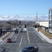
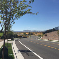
4800 West Roadway
4800 West Roadway was extended between 10200 South to Sky Drive over Bingham Creek; providing a more direct north to south route for the Glenmore and Daybreak communities of South Jordan City. The roadway is approximately 4,230 feet in length. Proterra researched the recorded property information and conducted a field survey to establish property ownership for each parcel of land that was impacted by the road widening. A topography field survey was also conducted to measure the natural and man-made features (utilities, etc.) within the impacted area. All measurements were documented in an as-built topography survey map that was utilized for the project’s engineering design work. Based upon the engineering design, Proterra designed the right-of-way maps and prepared the documents for acquiring the necessary right-of-way and easements. The project was contracted and funded by the Utah Department of Transportation and South Jordan City.
Land Surveying
The Reserve
The reserve is a single-family residential development located at the intersection of Bates Canyon Road and State Road 36, Stansbury Park. It consists of 140 lots and open space reserved in a conservation easement. Based upon an existing boundary survey, Proterra conducted an introduction survey to establish survey control and topography survey map to be utilized for engineering design. The property is being developed in seven construction phases and Proterra prepared ALTA/NSPS land title survey maps and subdivision plats for each construction phase. Proterra also provided construction surveying services and survey staked the sanitary sewer system, storm drain collection system, culinary water system, roadway improvements, and property corners.
SERVICES
Land Surveying
Our surveyors understand that successful projects begin and end with accurate and timely surveys. Our mapping staff can provide research through final boundary resolutions. Our construction staking staff understands it costs money to have equipment sitting idle on the site and boasts of its twenty-four-hour turnaround for construction staking requests. Our portfolio includes single-family and multi-family residential developments, education K-12, industrial, infrastructure, office, recreation, religious, retail, and public works.
Herriman
Townes
10000 South
Roadway Widening
Boulder Canyon
Apartments
Granite High School
ALTA/NSPS Land Title Survey
The Cottages
at the North District
4800 West
Roadway